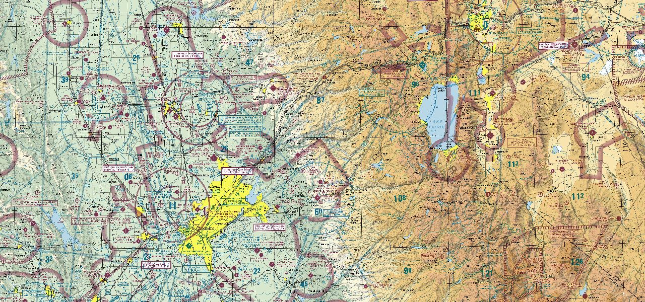
Charts & plates
Every FAA chart, current
VFR, IFR and TAC plus approach plates — sharp offline.
Charts, plates, weather and planning in one place — with a copilot that listens on the radio and a debrief that writes itself. Same app on every screen.
Live Transcribe keeps up when the frequency gets busy. The camera files your shots against the flight. Debrief replays all of it on the ground.
Runs on the device, so no signal needed. Squawks, altitudes and frequencies are pulled out for you — tap a line to keep it.
Photos and video from inside the app — stamped with position, altitude and time, and filed against the flight you're on. Front and rear at once for the panel and the view.
Scrub the track with video and radio audio in sync. Takeoff, turns, max altitude and landing are marked for you. Send it to your CFI.
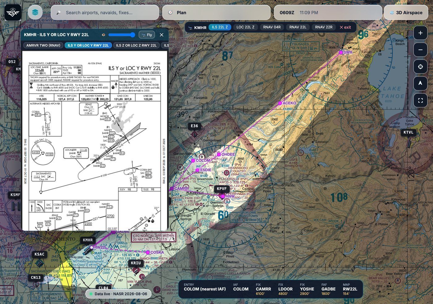
Open any d-TPP plate as an overlay with a transparency slider, switch between the airport's charts without closing it, then press 🛬 Fly and the instrument approach is drawn natively on the chart from CIFP data.
Drag it, resize it, fade it from 15% to 100% so you keep the terrain underneath. Switch charts without closing it.
Every transition, the final with per-leg minimums, and the missed — drawn from CIFP and auto-fit, with the clutter dimmed.
It picks your entry (nearest IAF, or vectors-to-final) and walks the legs with you as you fly them.
Not a desktop app with cut-down companions. Plan at the desk, brief on the pad, fly with the phone — it all syncs, and what you downloaded still works with no signal.
The planner knows the weather. The assistant knows your route. The lesson knows what you flew.
VFR, IFR and TAC plus approach plates and airport diagrams — downloadable, sharp offline.
METAR, TAF, MOS and winds aloft in plain English, with nearby stations when your field is silent.
Reads the same data the map draws from, and cites product, edition and timestamp.
Drag the course line, drop a fix anywhere, get an ICAO nav log with winds and legal altitudes.
Own-ship, traffic and terrain awareness — plus live transcribe on a busy frequency.
Training that follows your real flights — replay, maneuvers, endorsements and 8710.
Ask one question instead of running six lookups. It shows its work every time. The assistant queries the same platform that renders the map — airports, weather, airspace, plates, your aircraft and your logbook. That's what lets it correlate. “Is the crosswind within limits at every alternate?” is one question, not six.
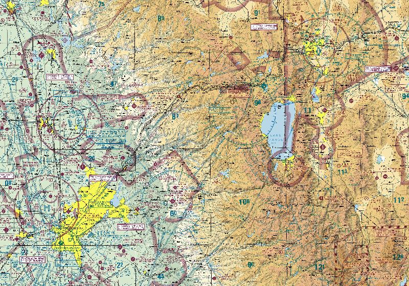
It checks the weather, terrain, airspace and your aircraft, then draws the options on the map and says which one it would file — and why.
Keeps you 3 400 ft above the highest terrain on the leg and north of the SIGMET. Freezing level is 12 500 — you stay below it the whole way.
14 NM shorter, but 13 000 puts you in the freezing level with an AIRMET ZULU along the ridge — and the Bonanza has no known-ice approval.
Drag the course or type it. Airways expand, legal altitudes check against the winds, and it files.
A real logbook, not a flight list. Currency is computed from the entries you actually logged; the 8710 and endorsements come out the other end.
A real Part 61 program built around the tail you fly, gradeable by your CFI — not textbook links.
Registry identity, TCDS type data, weight & balance, maintenance and checklists on one record — entered once, used everywhere.
FAA and NOAA products, with the edition and time shown. If we can't source it, we don't show it.
Charts, weather, planning and training in one place.